“Everything trickles down to the local government to implement. Regardless of who makes the law, it’s the local government that will implement some part of it…so you need to look at the local government scale if you want to make actual change on the ground.”
~ local planner, Minnesota
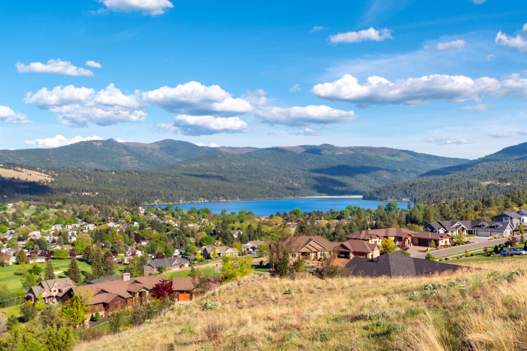
 Wildlife don’t stop at city limits, county lines, or property boundaries—and neither should local government planning. The decisions communities make today about how and where to build will shape whether future generations inherit thriving landscapes that sustain people and wildlife alike.
That’s why CLLC created a new report on wildlife habitat connectivity and local government: to bring together the policy tools and practical strategies that every community and every community member—whether you’re a resident, planner, biologist, developer, or legislator—can consider using to help keep landscapes connected.
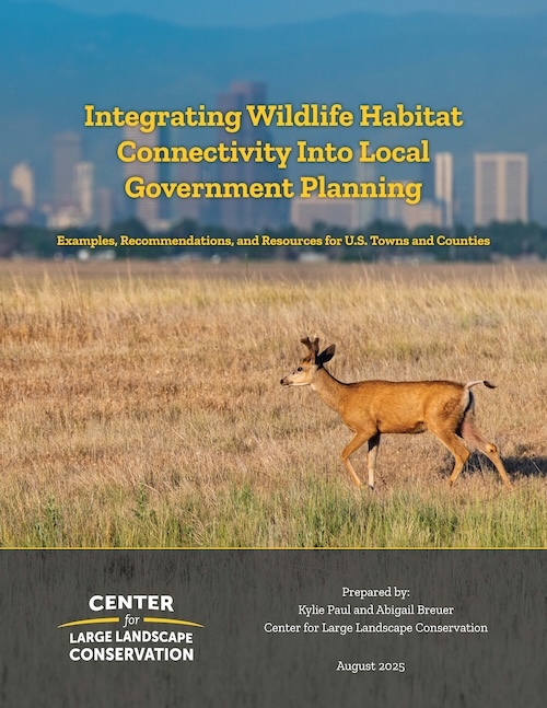
The report, titled Integrating Wildlife Habitat Connectivity into Local Government Planning: Examples, Recommendations, and Resources for U.S. Towns and Counties, is a practical guide for planners and partners to weave wildlife habitat connectivity into local land use decisions. It features sample policies and ordinances from across the country, case studies of successful implementation, and best practices to support local action.
Kylie Paul, road ecologist with the Center for Large Landscape Conservation and lead author of the report, says that local governments hold land use authority across most of the U.S. and have a unique role in shaping growth, protecting natural resources, and keeping landscapes connected.
“Planning for connectivity isn’t just about wildlife,” said Paul. “It’s a smart growth strategy that supports open space, green infrastructure, water quality, road safety, recreation, and community resilience.”
Examples from the report include:
- The city of Buckeye, Arizona created a Wildlife Corridors Best Practices Guide to help planners plan for future development with wildlife in mind.
- Lake County, Florida’s Comprehensive Plan includes a Florida Black Bear Scenic Byway Corridor Overlay District, with language to establish standards to create and maintain a safe corridor for both wildlife and people, including the construction of wildlife crossing structures.
- Scott County, Minnesota has mapped Natural Area Corridors to guide development away from the corridors through incentives and to improve natural resource functions within them.
- The state of Vermont has a Community Wildlife Program offering technical services and information to local governments to help find natural resource information, review town planning documents, connect with other partners, and focus on a larger regional scale for planning.
The report highlights steps towns and counties can take, such as mapping priority habitat, clustering development, securing open space, and requiring buffers around sensitive resources. It also outlines tools like conservation design, overlay zones, and wildlife crossings, along with state-level policies and partner actions that provide critical support.
“As development pressures rise, now is the time for local governments to embed habitat connectivity into comprehensive plans, zoning, and development review,” said Paul. “We hope the practical examples and policy language in this report will help inspire and guide communities to protect landscapes for both people and wildlife.”
If you care about strong communities, healthy environments, and smart growth, this report is for you.
The full report is available at: largelandscapes.org/local-planning
Support for this project was provided by The Pew Charitable Trusts.
Top photo: A suburb of Spokane, Washington, USA – Adobe Stock