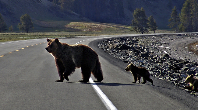
United States Program

Creating Safe Passage for People and Wildlife

Animals need to move. By doing so they shape and maintain the landscapes in which they live by transporting seeds, pollinating plants, and controlling pests. They also help shape the cultural identities of the people who live in these landscapes.

We use science such as spatial models and maps to help planners throughout the U.S. identify how and where animals move across the landscape, and how people help or hinder that movement. We apply this knowledge to support on-the-ground action, from helping wildlife safely cross roads to identifying and protecting vital ecological linkages.

In addition to this technical guidance, the Center provides policy advice and expertise. We work with national, state, and local decisionmakers and stakeholders to collaboratively develop, advance, and implement policies that protect wildlife movement, reconnect habitat, and support conservation at the landscape scale.

Creating Safe Passage for Desert Tortoises

Desert Tortoises need to move—and often cross roads—to find food, to reach water, and for other activities essential for survival. Unfortunately, this threatened species is being struck and killed by the thousands each year by motorists in the southwestern US, and their population numbers continue to decline. The Center is working with the US Fish and Wildlife Service and other public and private partners to minimize tortoise deaths along roadways. The initiative aims to establish standard policies and practices that can be implemented consistently across the Desert Tortoise’s four-state range, with the goal of providing safe passage for these animals across roads. Learn more

Illustrations 05

Report Introduces New Tools to Help Slow the Loss of Sagebrush Habitat

A staggering 1.3 million acres of sagebrush habitat are being lost annually, as outlined in a new report from the U.S. Fish and Wildlife Service and U.S. Geological Survey. Known as the Sagebrush Conservation Design, this report can be used by partners—such as government agencies, nonprofit organizations, and Tribes—that are working in sagebrush country toward shared goals. By using the maps in the report to prioritize the most important places to restore sagebrush ecosystems, conservation efforts can be more effective and efficient for the greatest benefit of the people and wildlife who rely on this uniquely western ecosystem. Learn more

Blue Flowers And Sage Below Wyoming Range, Wind River Mountains.

Promoting Citizen Science Through a Smartphone App

New technology has created an opportunity for the public to collect data that will help make roads safer for wildlife and motorists. The Center partnered with Montana State University Western Transportation Institute (WTI) and ARC Solutions to make the ROaDS (Roadkill Observation and Data System) tool available to states, tribes, and nonprofit organizations through a smartphone app. Developed by WTI, US Fish and Wildlife Service, and the National Park Service, the app enables uniform data collection on roadkill and sightings of live animals on or near roads. By making this data-collection tool widely available, and providing technical assistance on its use, the Center is helping natural resource managers and transportation planners better understand wildlife movement patterns to help reduce wildlife-vehicle collisions. Learn more

Illustrations 07

Blackfeet Animal-Vehicle Collision Reduction Master Plan

The first-ever reservation-wide animal-vehicle collision study in the United States was conducted by the Center in partnership with the Blackfeet Nation Fish and Wildlife Department. The completed Animal-Vehicle Collision Reduction Master Plan provides the Blackfeet Nation with a blueprint to reduce wildlife and livestock collisions on the road stretches with the highest incidence of collisions through mitigation projects proposed in the plan. Learn more

Istock 000000626432 650x362

Stay informed

Join our email list for news and updates.

Subscribe