
 On the border with Uzbekistan, and close to the border with Afghanistan, Turkmenistan’s “Mountain Ecosystems of Koytendag” (MEK) make up one of the most distinctive and richly biodiverse landscapes in Central Asia. However, the area faces mounting threats to its conservation, including agricultural expansion, overgrazing, illegal hunting, and unmanaged tourism. As part of our project Connectivity, Capacity, and Cats: Building Resiliency in the Mountain Ecosystems of Koytendag funded by the Critical Ecosystem Partnership Fund (CEPF), national and international experts traveled around this extraordinary region from 5-11 April 2023. Among the goals was to help evaluate the possibility of it being officially designated as a UNESCO Natural World Heritage Site.
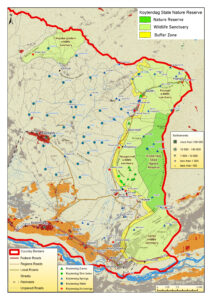
This field mission, conducted in cooperation with staff from across Turkmenistan’s protected area system and the Norwegian Institute for Nature Research (NINA), was focused on Turkmenistan’s Koytendag State Nature Reserve (SNR). Located in Lebap Province in the far east of the country, Koytendag SNR is one of the most biodiverse areas in Turkmenistan and home to important species such as urial sheep, lynx, and markhor. But while Koytendag SNR is classified as a zapovednik, a term used in post-Soviet Union countries for protected areas intended to be kept “forever wild”, four adjacent State Wildlife Sanctuaries named Garlyk, Hojaburjybelent, Hojagaravul, and Hojeypil have lesser degrees of protection.
To help support conservation efforts on the ground, the project’s field missions have focused on coordinating species monitoring by scientific staff and rangers using SMART (Spatial Monitoring and Reporting Tool) data gathering, as well as awareness-raising in local communities around how to protect the great diversity of endemic plants, birds, and ungulates. The following report details the most recent field mission conducted with the aim of understanding how best to improve management of the MEK—both the protected areas and surrounding “un-protected” but biologically important lands—and to improve the knowledge base necessary to justify its nomination and eventual Natural World Heritage Site designation.
Day One: 5 April
The Expert Team traveled to the city of Kerki in eastern Turkmenistan. They then drove approximately three hours farther east in three vehicles to the headquarters of the Koytendag SNR located in the municipality of Bazardepe Set at the base of the mountains. Upon arrival, they met Mametsheripov Muhammet (Director) and Shaniyaz Mengliev (Head of the Scientific Department).
Day Two: 6 April
One of the most distinct features of the Koytendag SNR and adjacent Sanctuaries are the deep limestone canyons with grassy plateaus providing important habitat for diverse species of flora and fauna. The team explored Daraydere Canyon, one of the deepest and most spectacular in the mountain range, and saw Daraydere Spring and its resulting stream that supports many rare and endangered plants, birds, and animals. While in the canyon, the team documented the presence of birds including black vultures, Egyptian vultures, kestrel, chukar and see-see partridge, along with sightings of markhor and signs of porcupine presence (quills). Pistachio trees, two species of almond tree, and many other plant species were also documented.
Day Three: 7 April
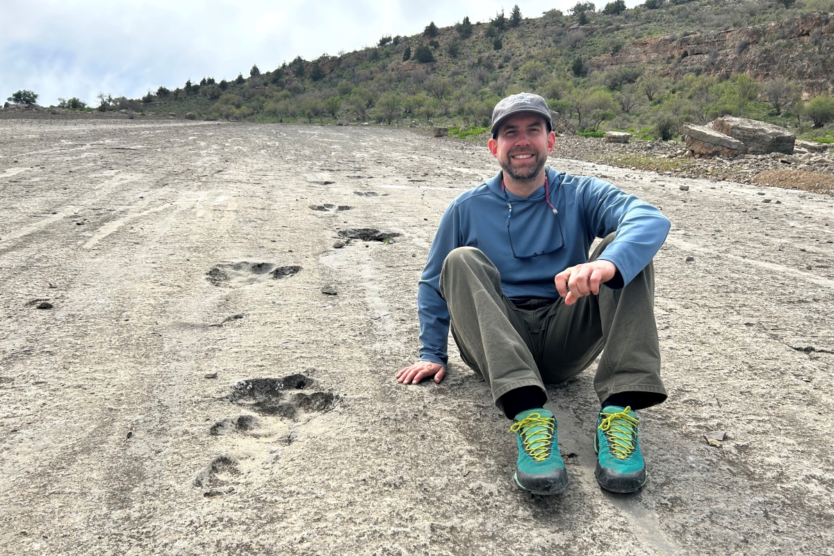
The team drove through the town of Koyten on the way to significant areas of the Hojeypil Valley. These included the ‘Dinosaur Plateau’ (Dinozawlarynyň Belent Tekizligi), where visitors can walk beside footprints from multiple species of dinosaur that were fossilized into the limestone approximately 145-150 million years ago.
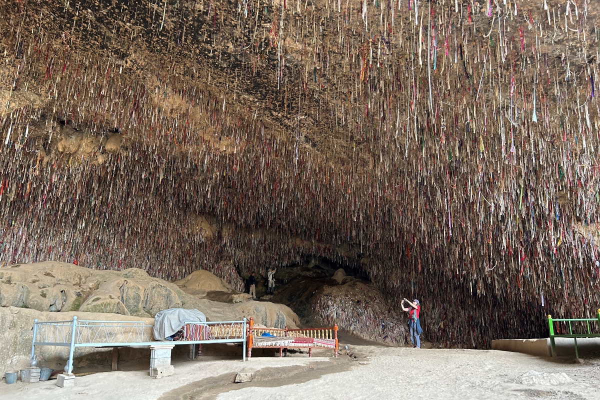
At the sacred site ‘Grotto of Forty Girls’ (Kyrkgyz Grot), team members added to the thousands of prayer ribbons suspended from the ceiling with red mud gathered on the cave floor.
The group also stopped at the 200+ year-old Unabi/Zizifus Forest, sacred for its limbs bending toward Mecca. The trees here provide the unabi, or zizifus fruit, known for its medicinal properties.
Returning along the Hoytenderya River, the team spoke with people in the communities of Koyten, Hojeypil, and Gushunly Set, including drivers, horse owners, and vendors at local markets providing services for tourists.
In the afternoon, members of the team met with local authorities (Archynlyk) to discuss ongoing work in the field, contributions toward the UNESCO nomination process, and opportunities and benefits for local communities. Hosts of the meetings included Azamat Abdullaev (Archin, responsible for Koyten Set), Nigara Amandurdyeva (Deputy Archin), and Gulsere Mammedova (Deputy Head of Koytendag Etrap Hakimlik, responsible for cultural issues).
Day Four: 8 April
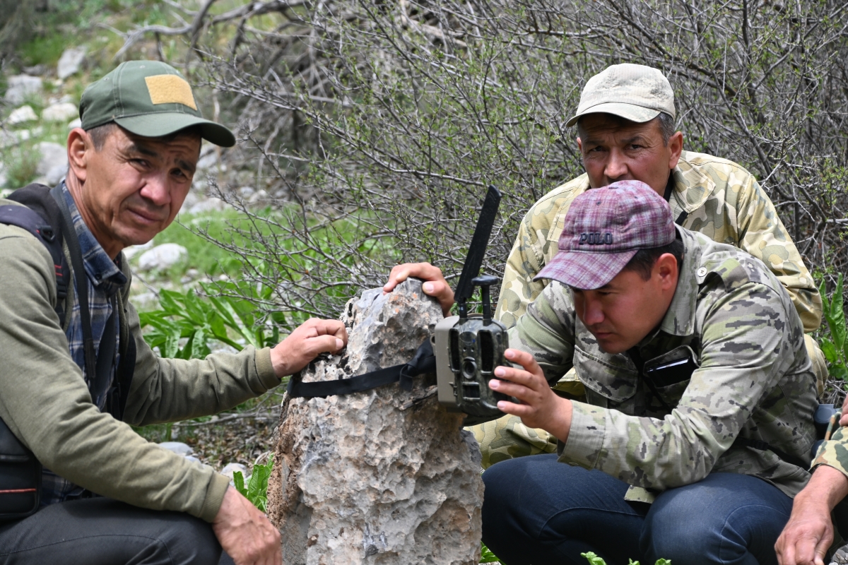
The team made their first trip into the Koytendag SNR to a location in the core area known as Maydan. The drive progressed from the Reserve headquarters in the valley, through the Hojagaravul Wildlife Sanctuary, and into the higher elevation juniper forests. After meeting with rangers working in the area, the team hiked into the bottom of a shallow canyon to check wildlife camera traps placed in previous months. Identifying wildlife scat on the way, the team viewed the camera trap footage including evidence of lynx, hare, porcupine, and numerous birds. Moving to a new observation area, endemic wild tulips were spotted before a brief rainstorm moved in. In the afternoon, hikes along the plateaus and canyon ledges led to observations of markhor, vultures, and birds of prey.
Day Five: 9 April
Working from Maydan ranger station, the team moved higher on the plateaus and identified lynx scat and observed hare, multiple birds, and an abundance of different plants and flowers. Urial sheep were also seen moving into a canyon thanks to the trained eyes of the accompanying rangers. The team moved down the plateau, inched quietly toward the edge of the canyon, and was rewarded with the sight of two urial sheep in the bottom.
Day Six: 10 April
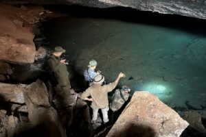
The team visited the Kaptar-Khana Cave which runs approximately 3 kilometers into the limestone ground and features a hydrological connection to the Hoytenderya River where a number of small fish could be seen swimming in the shallow water. In the afternoon, the team headed into the core area of Koytendag SNRtoward the mountain Ayrybaba – the highest point in Turkmenistan. After setting camp at Helpebaba in the juniper forest below the base of the mountain, the team hiked into a neighboring canyon to check camera traps near one of the few water points in the area. Camera trap footage included recordings of lynx, porcupine, and a number of songbirds. The group then moved to the edge of the canyon to continue observations, eventually including young markhor playing on the steep ledges, as well as vultures, kestrel, and other birds of prey. Back at camp, the team witnessed a large mating event of beetles.
Day Seven: 11 April
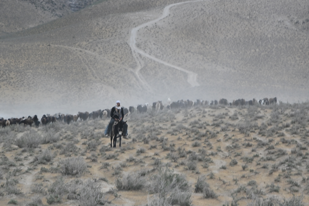
As the sun rose above Ayrybaba, team member John Linnel observed a large group of markhor, many of them full grown, larger males. The remainder of the morning was spent hiking around the higher elevations of Koytendag SNR. During the return trip through the Sanctuary, the team talked to shepherds working their flocks in the area of Bazardepe Set. They discussed issues regarding the sustainable use of pastures, such as how many years they had worked there, the number of sheep being watched for local communities, and alternative employment opportunities to shepherding. Overall, it was noted that jobs are scarce in the villages and the demand for shepherding continues to increase.

After many productive and adventurous days, the team departed Koytendag SNR on 12 April. A full mission report is now being prepared to record overall findings and recommendations for enhancing conservation activities, updating the UNESCO nomination dossier, and achieving status as a Natural World Heritage Site. Initial reporting details a total of 61 species of bird, three species of medium to large mammal, and seven reptiles observed directly by the team. In addition, camera trap images from two to three weeks prior to the field mission and field signs observed during the mission provided evidence of wolves, Eurasian lynx, porcupines, Tolai hare, red fox, markhor, and urial within the core of the SNR.
Following the mission, a meeting on 17-18 April entitled “Connectivity Conservation Workshop – Ecological Networks for Koytendag State Nature Reserve (SNR)” brought together experts in the capital of Ashgabat to share the newly documented information and discuss further efforts for conserving and connecting this special landscape.
The Critical Ecosystem Partnership Fund is a joint initiative of l’Agence Française de Développement, Conservation International, the European Union, the Global Environment Facility, the Government of Japan and the World Bank. A fundamental goal is to ensure civil society is engaged in biodiversity conservation.
Additional thanks are to be paid to colleagues that contributed to the success of the mission, including Serdar Boriev (Scientific specialist) responsible for SMART monitoring, Islam Dovletov (Assistant for organizational issues and rangers), and other reserve staff including Yuldash Hamalov, Murat Dzhanpoladov, Adyldzhan Bahtyyarov, Dostymurat Kenjaev, Merdan Dostymyradov, Koyly Ismailov, Dzhumabay Tursunov, Nurmyrat Tursunov, Renat Tanrakulov, and Bayram Dzhaniyarov.
View photos from the field expedition:
-
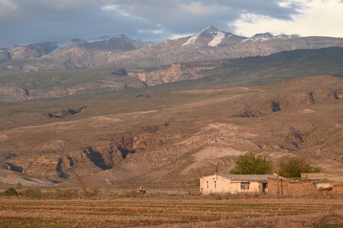 A view of Turkmenistan’s highest mountain, Ayrybaba, from the reserve's headquarters. (Courtesy: John Linnell)
 -
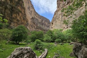
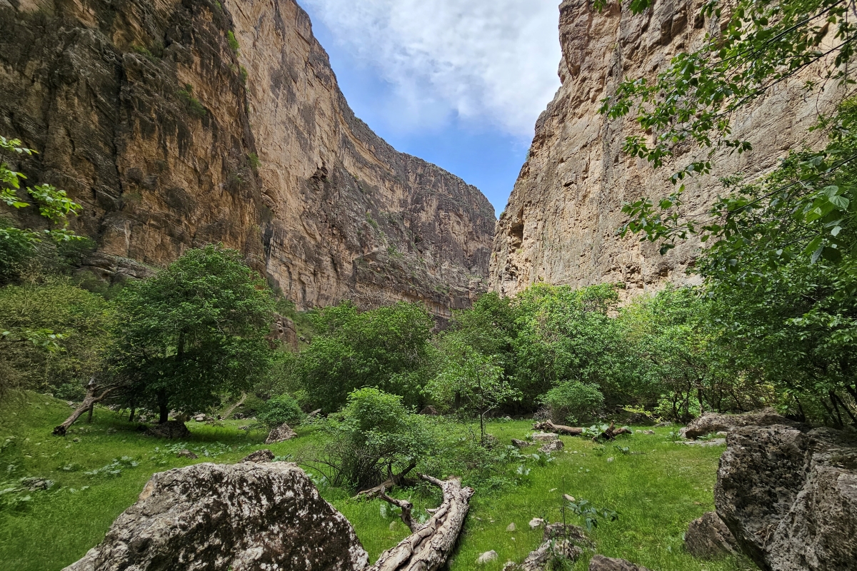 View from the bottom of Daraydere Canyon, one of the deepest and most lush canyons in the reserve (Courtesy: Atamurad Veyisov)
 -
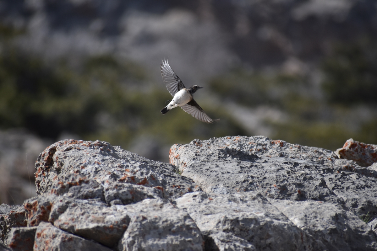 Many bird species find refuge in and among the canyons and plateaus of the reserve. (Courtesy: Khodjamurad Khodjamaradov)
 -
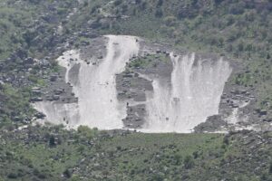
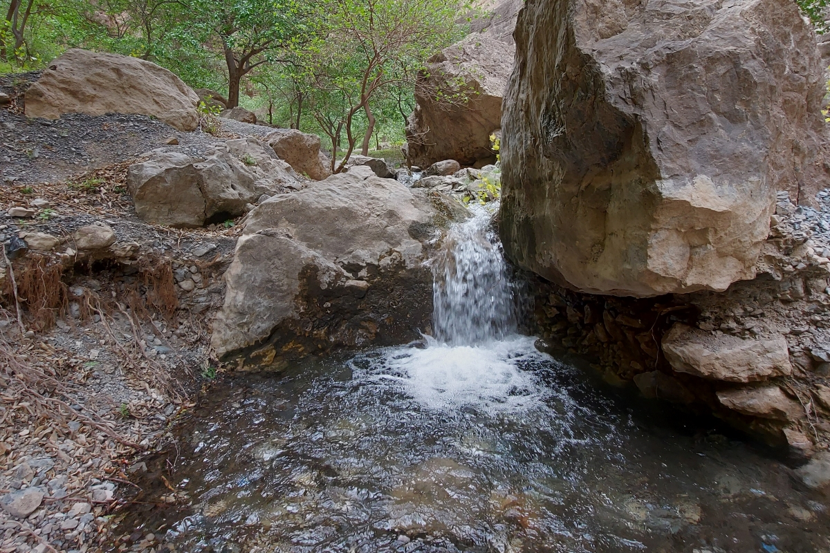 The Daraydere Spring emerges from the canyon's limestone boulders and its waters are piped to residents in the valley below. (Courtesy: John Linnell)
 -
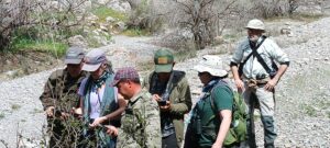
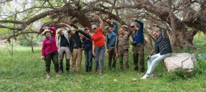
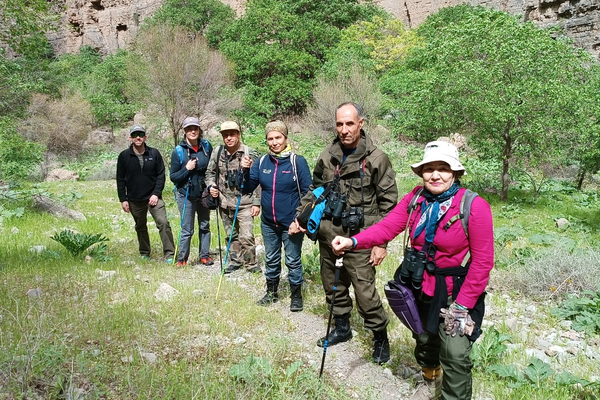 Members of the expert team in Daraydere Canyon. L-R: Aaron Laur, Tatjana Rosen, Khodjamurad Khodjamaradov, Aknabat Potaeva, Arazmurad Amanov, and Shirin Karryeva (Courtesy: Shirin Karryeva)
 -
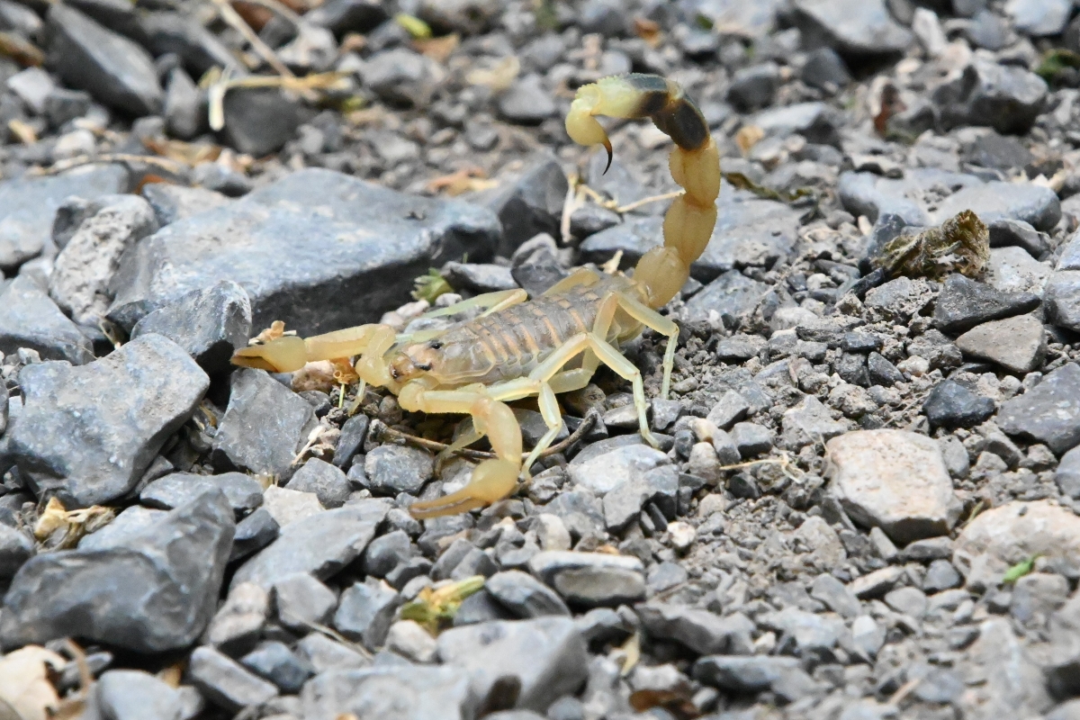 Mesobuthus gorelovi is a scorpion species found in the area and first formally described in 2018. (Courtesy: John Linnell)
 -
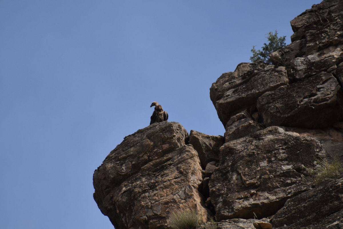 A Griffon vulture on the rim of Daraydere Canyon. (Courtesy: Khodjamurad Khodjamaradov)
 -
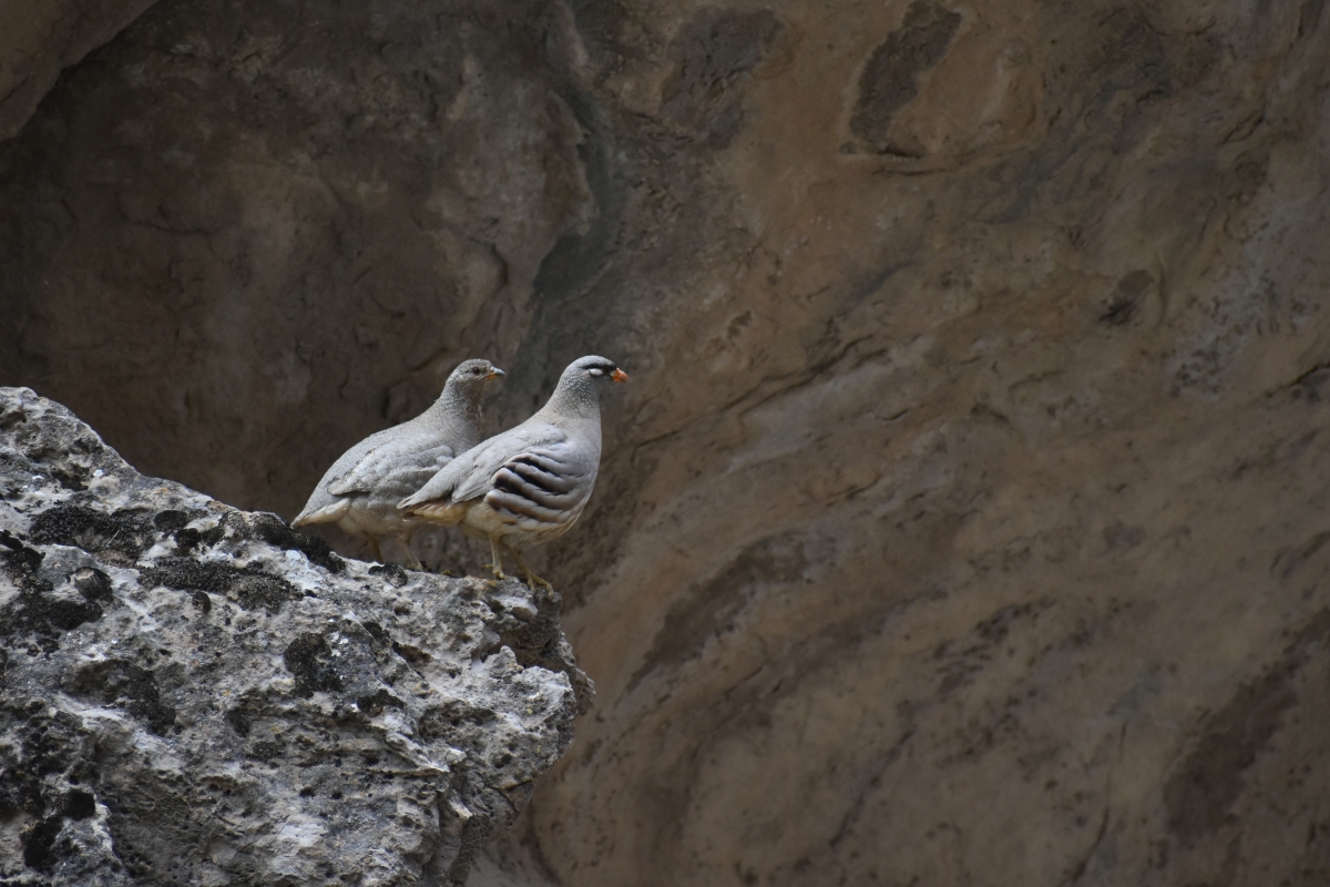 A Chukar pair in Daraydere Canyon. (Courtesy: Khodjamurad Khodjamaradov)
 -
 The ‘Dinosuar Plateau’ seen from the Hojeypil Valley below. (Courtesy: John Linnell)
 -
 Aaron Laur, CLLC/CEPF Project Coordinator next to fossilized dinosaur footprints on the plateau. (Courtesy: Aaron Laur)
 -
 Tatjana Rosen visiting the sacred site ‘Grotto of Forty Girls’. (Courtesy: Aaron Laur)
 -
 Shepherd moving a flock in Hojagaravul Wildlife Sanctuary (Courtesy: John Linnell)
 -
 Team members checking camera traps in the Maydan area of the reserve. (Courtesy: John Linnell)
 -
 Team members with rangers of the Koytendag SNR in the Maydan area of the reserve. (Courtesy: Shirin Karryeva)
 -
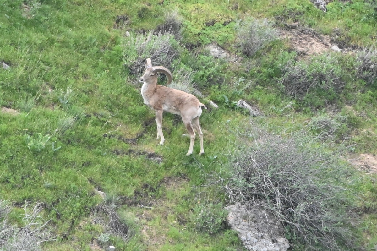 Urial sheep move in and out of canyons and across the plateaus. (Courtesy: John Linnell)
 -
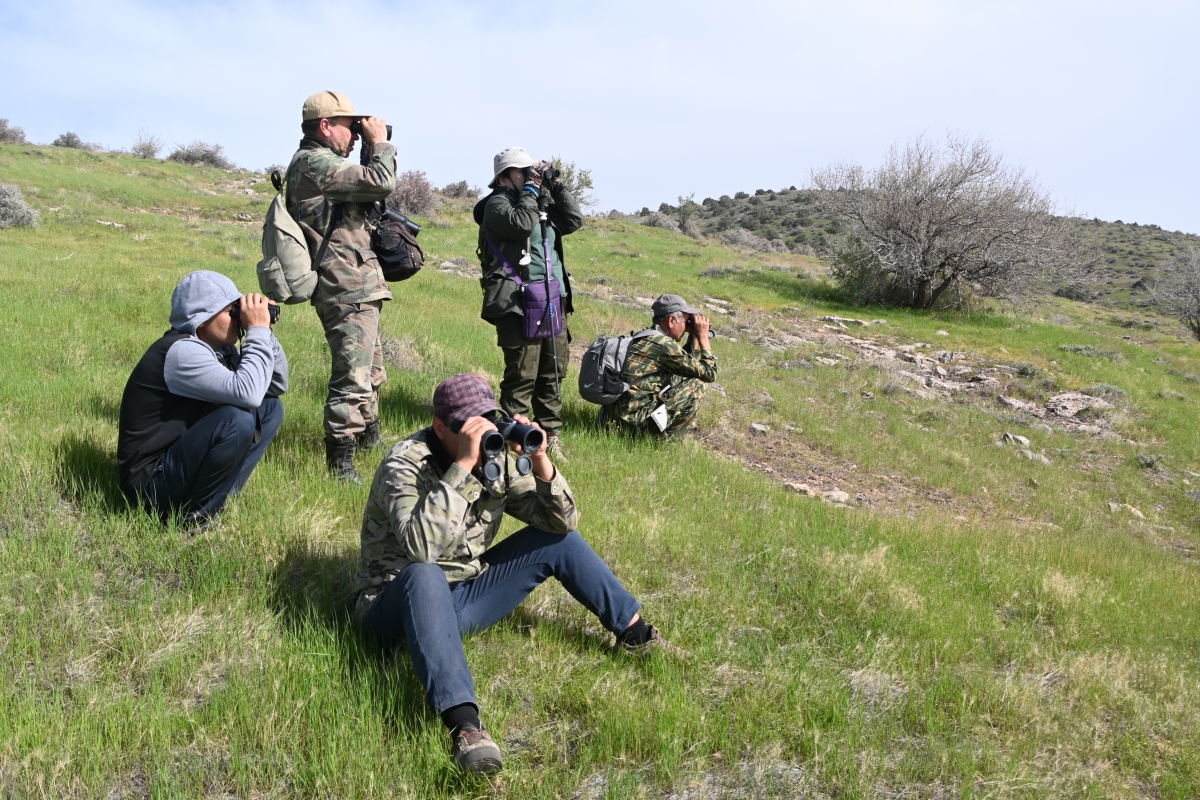 Team members set their well-trained eyes toward locating wildlife in the rocky terrain. (Courtesy: John Linnell)
 -
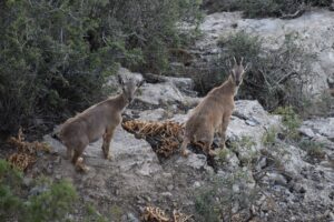
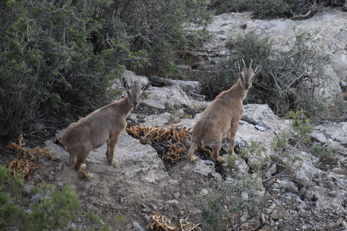 Young markhor moving up the wall of a canyon. (Courtesy: Khodjamurad Khodjamaradov)
 -
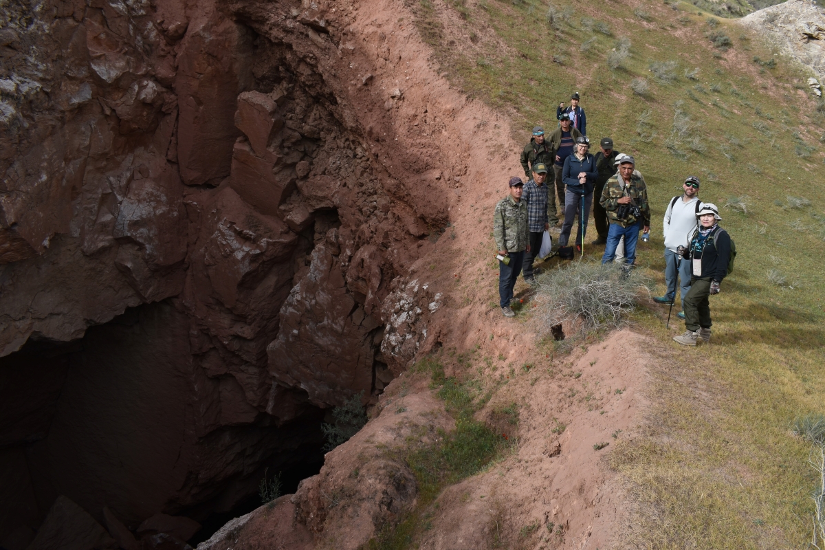 Team members preparing to enter Kaptar-Khana Cave. (Courtesy: Khodjamurad Khodjamaradov)
 -
 Kaptar-Khana Cave glistens with gypsum walls and blue-green waters that are home to small fish. (Courtesy: Khodjamurad Khodjamaradov)
 -
 Team members with rangers of the Koytendag SNR in the Helpebaba area of the reserve. (Courtesy: Shirin Karryeva)
 -
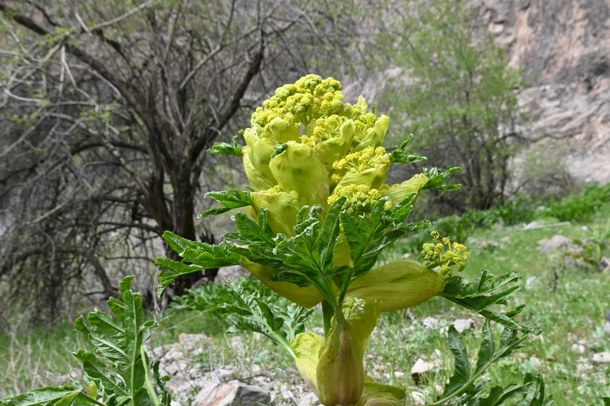 One of over 50 species of medicinal, water-collecting Ferula plants found in Turkmenistan. (Courtesy: John Linnell)
 -
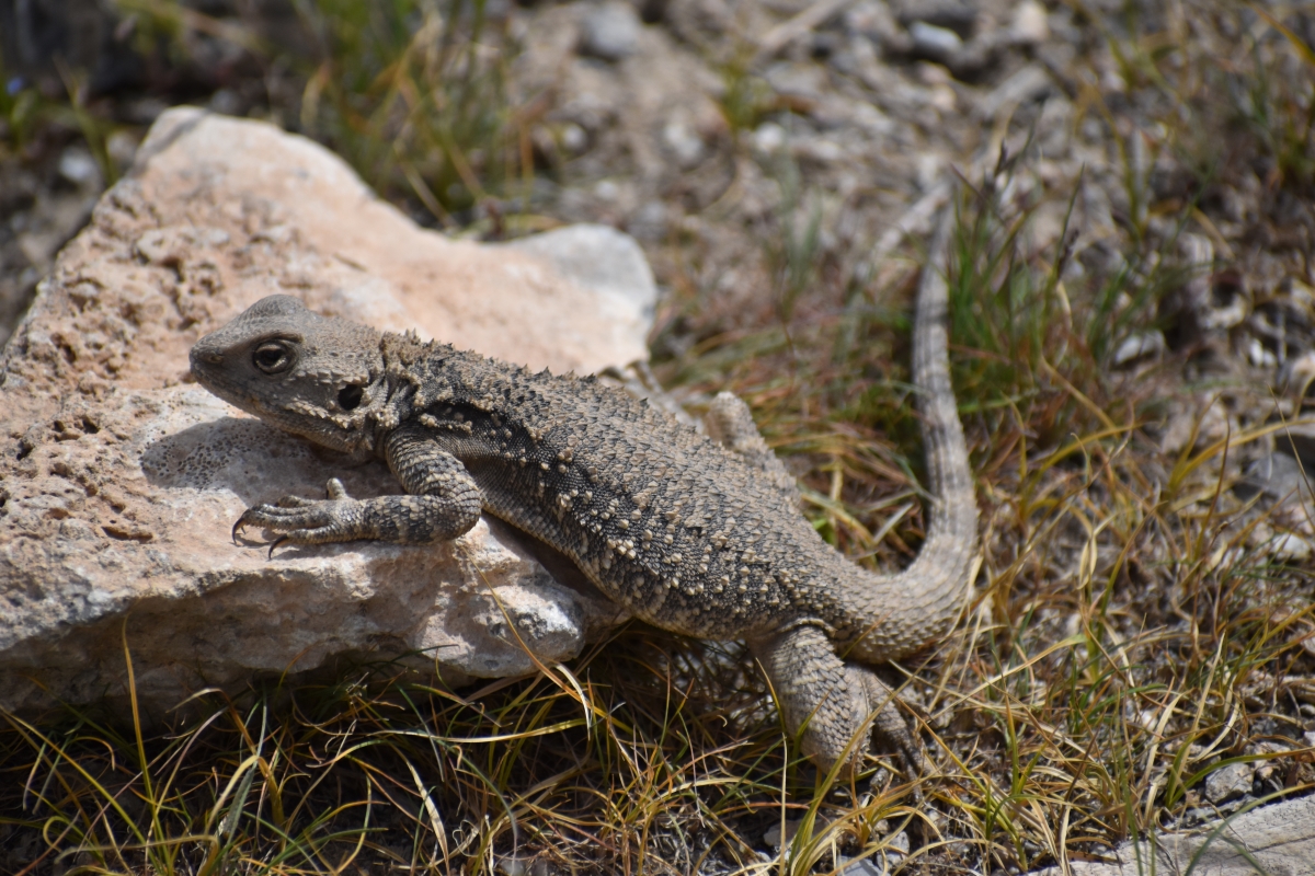 Lizards are found across the State Nature Reserve. (Courtesy: Khodjamurad Khodjamaradov)
 -
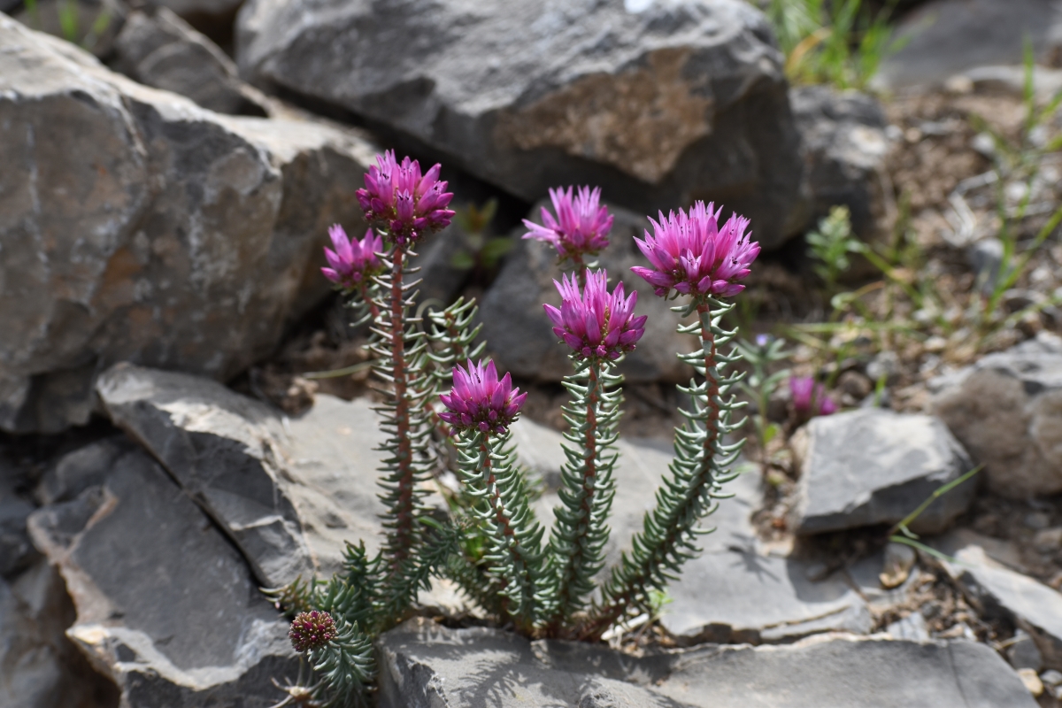 Flowers spring from between the limestone rocks in the reserve. (Courtesy: Khodjamurad Khodjamaradov)
 -
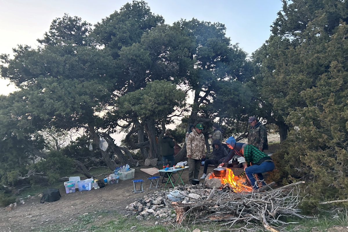 Making camp in the Helpebaba area of the reserve. (Courtesy: Aaron Laur)
 -
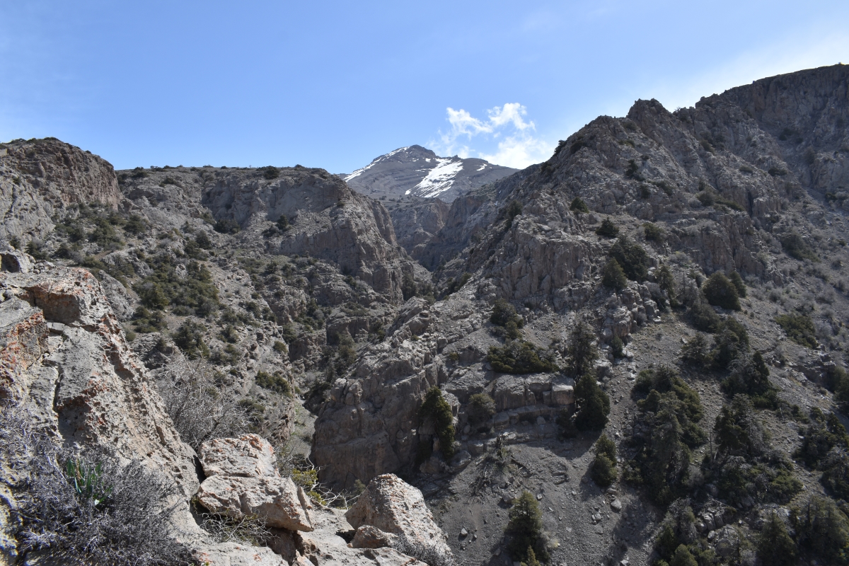 The mountain Ayrybaba viewed from a canyon below. (Courtesy: Khodjamurad Khodjamaradov)
 -
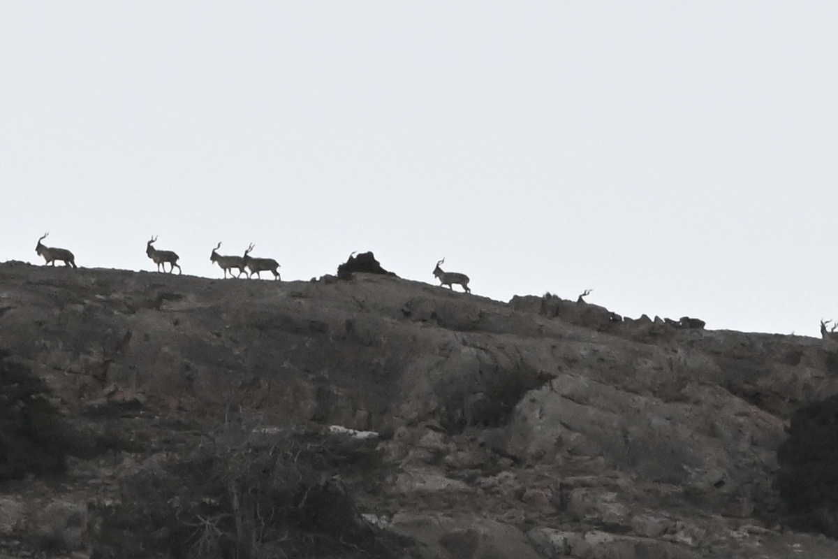 A large group of markhor move along the high ridges below the peak of Ayrybaba. (Courtesy: John Linnell)
 -
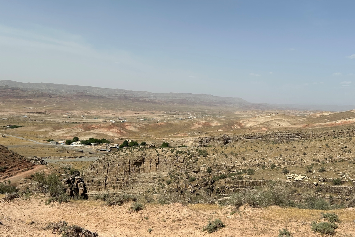 A view of the Hoytenderya River Valley from the Hojagaravul Wildlife Sanctuary. (Courtesy: Aaron Laur)
 -
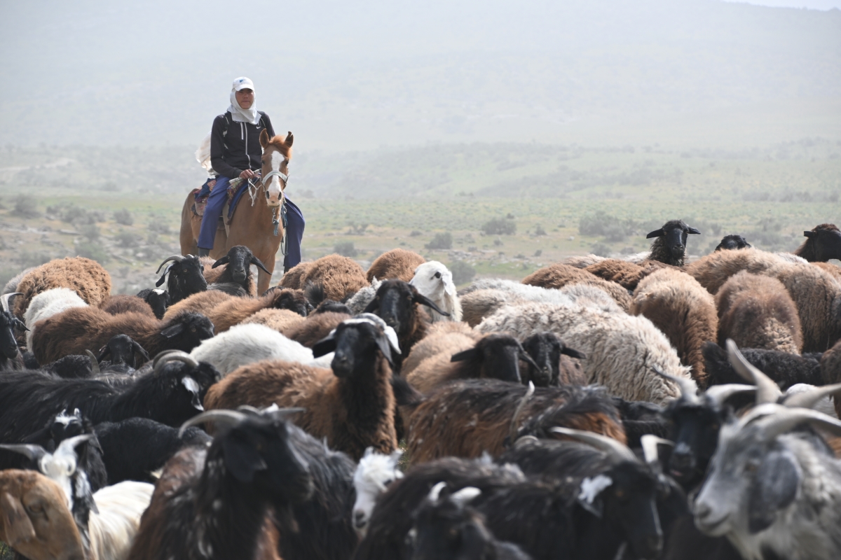 A shepherd grazing fat-tailed sheep and goats in the Hojagaravul Wildlife Sanctuary. (Courtesy: John Linnell)
 -
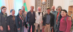
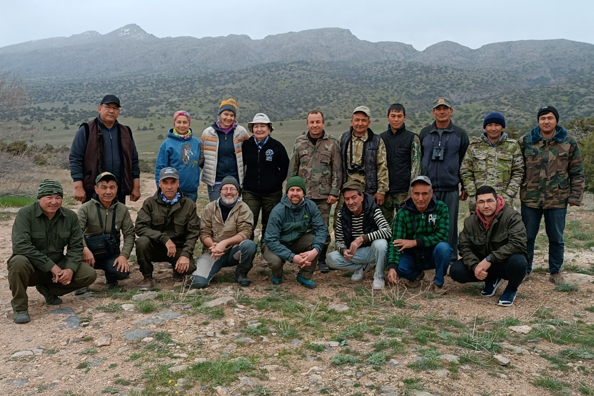
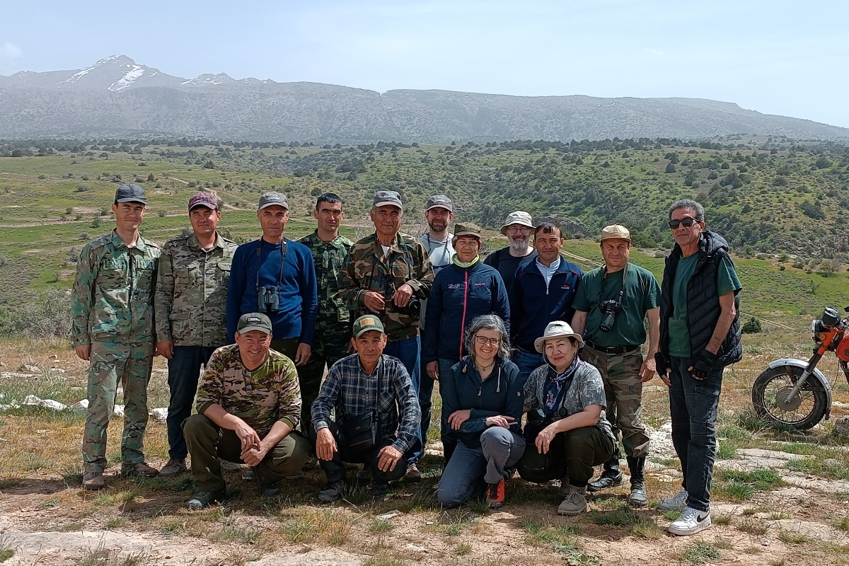
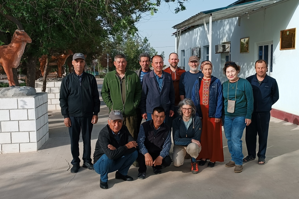 At Koytendag SNR headquarters. L-R back row: Arazmurad Amanov, Atamurad Veyisov, Aman Kurabov, Mametsheripov Muhammet, Aaron Laur, John Linnell, Aknabat Potaeva, Shirin Karryeva, Khodjamurad Khodjamaradov. Front row: Nurmuhammet Khudaikuliyev, Shaniyaz Mengliev, Tatjana Rosen. (Courtesy: Shirin Karryeva).
Top photo: Ayrybaba from the valley: A view of Turkmenistan’s highest mountain Ayrybaba from the Koytendag State Nature Reserve (SNR) headquarters. (Courtesy: John Linnell)