A Special Feature of the 2024 Annual Report
When lynx, elephants, markhors, bears or elk move in search of new water or food sources, they don’t stop to show their passports at the border or pause to consider which areas are designated as protected and which are private lands. Wildlife goes where it needs to survive, and as climate change modifies landscapes and an increased human population adds pressure to ecosystems, conflict arises.
In 2024, the Center for Large Landscape Conservation worked across five continents to reconnect fragmented landscapes and foster partnerships across borders. Three projects in particular illustrate the challenges and opportunities of preserving wildlife movement and habitat connectivity across international boundaries. This collaborative work is taking place in the Mountain Ecosystems of Koytendag in Central Asia, the Transboundary Region of Kenya and Tanzania and the landscapes of Northeastern North America.
Conserving the Mountain Ecosystems of Koytendag
Along the shared border of Turkmenistan and Uzbekistan runs a tall, craggy ridgeline separating the two countries. While this southern spur of the Pamir-Alay mountain range may present a physical barrier for human travel, many animals and crucial sources of freshwater can still move freely through this landscape nestled in the heart of the Mountain Ecosystems of Koytendag (MEK).
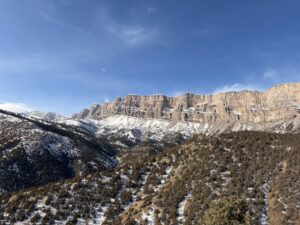
The MEK represent one of the most biodiverse landscapes in Central Asia. However, the region faces threats to endemic plant and animal species including agricultural expansion, overgrazing, illegal hunting and human development. Since 2020, the Center has been working in MEK as part of a project funded by the Critical Ecosystem Partnership Fund, and since 2024 by the Peace and Biodiversity Dialogue Initiative to help stakeholders in both countries come together to strengthen cooperation across two protected areas, including improving monitoring and data-sharing practices.
“Sharing common natural resources, ecosystems, and species, this project for Turkmenistan and Uzbekistan reinforces how international and transboundary cooperation can enhance conservation across Central Asia,” said Aaron Laur, International Connectivity Program, Policy and Partnerships Manager with the Center.
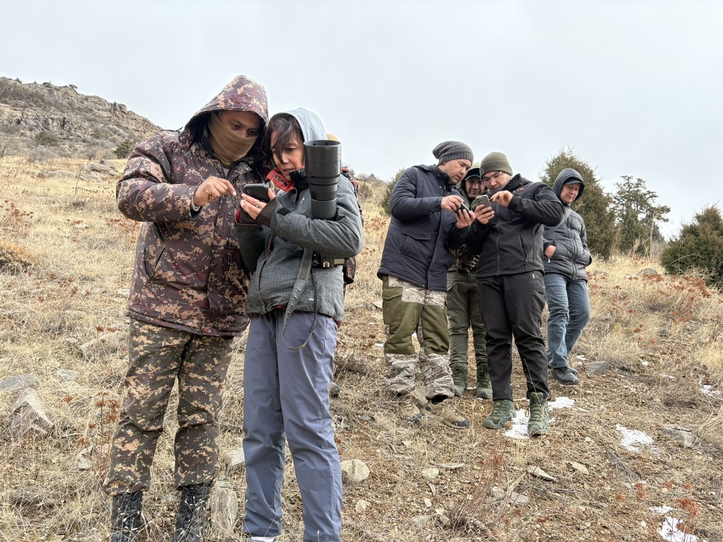
To combat the challenges faced by wildlife, rangers in Koytendag State Nature Reserve in Turkmenistan and Surkhan State Nature Reserve in Uzbekistan are collaborating to use Spatial Monitoring and Reporting Tool data gathering, or SMART monitoring, to track populations of markhor, urial sheep and lynx as well as other wildlife in the region. This data will help both countries make informed management decisions and enable them to deploy limited resources and rangers wisely across this vast landscape. For example, if a camera trap happens to capture an instance of poaching or other wildlife-human conflict, rangers will know exactly where incidents are happening and be able to better patrol and enforce management plans in the future.
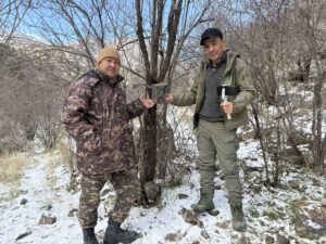
“Better data and more sharing of that data allows managers to make proactive decisions based on information they may have from the other side of the border,” said the Center’s International Connectivity Program, Policy and Partnerships Specialist, Gabriel Oppler, who traveled to Uzbekistan in 2024 to facilitate a workshop focused on enhancing collaboration and connectivity planning between the two reserves.
These monitoring efforts will also establish baseline information on migration and movement trends and population size and health that could then serve as future indicators of the effects of climate change. In addition, it will be helpful in supporting a transboundary nomination of both reserves as a UNESCO Natural World Heritage Site.
“A great deal of work went into building stakeholder surveys and our partners talking to people in the local community,” Laur said. “They sat with national and international experts and rangers on mountain tops for days at a time, gathering scientific information, and documenting natural, cultural, and geologic sites because that’s what goes into a World Heritage nomination.”
World Heritage status can be valuable in helping a country, or in this case countries, be recognized for stewarding their unique heritage and can help attract more international funding. Additionally, Laur said, this designation can help spur the governments of receiving countries to prioritize and better conserve the sites.
Oppler emphasized the importance of maintaining and enhancing connectivity between both reserves and the surrounding landscape and the shared interest of both countries in protecting the same wildlife populations and ecological processes. Though an international border runs through the heart of these mountains, for the local wildlife, it’s all one home range.
Connecting the Transboundary Region of Kenya and Tanzania
In the transboundary region of southern Kenya and northern Tanzania, or SOKNOT, there are protected areas on both sides of the border: the Serengeti, Mount Kilimanjaro and Amboseli National Parks and Tsavo National Park. The challenge in this region is to define, monitor and conserve wildlife corridors across international boundaries.

“There are a lot of wide-ranging species in the African landscape,” said Annika Keeley, Senior Conservation Scientist with the Center. “If you don’t care about connectivity between the countries, you damage populations on either side. Those countries depend on the species for tourism, and so if they want to sustain this business opportunity, they have to think about cross boundary connectivity for the species.”
Tanzania has delineated corridors that are recognized by the government but Kenya has yet to put any corridors on the map. The plan is for the two countries to collaborate, delineate corridors for the entire region and then monitor them.
“The goal is really to safeguard these corridors from being developed, to keep them open for wildlife movement,” Keeley said.

Working with WWF and the Wildlife Connect Initiative, Keeley and Bakari Mtili with the Center led and facilitated a two-day workshop in Tanzania focused on the shared goal of maintaining a connected landscape. The group discussed which indicators to use when monitoring these corridors and gathered input from local experts to make sure future work built upon existing efforts. Moving forward, both countries will share census and movement data to help researchers understand how species are using the corridors.
WWF also wants to monitor any delineated corridors to see if they are changing and use that data as an early-warning system. The human population of Tanzania is predicted to double by 2050 meaning lots of potential new development in these wildlife corridors. The new set of indicators laid out in a report from the Center will provide information on how the corridors are changing over time and inform future work.
According to Keeley, the Center’s recommendation is to create a framework for implementing the ecological corridors in this region following guidelines produced by the Center and the International Union for Conservation of Nature. For each delineated corridor, there would then be a group of local stakeholders that meets to write and execute a management plan, as well as monitor and adapt actions for the long-term stewardship of the corridor.
Collaborating to Protect Turtle Island
Many Native American communities use the term Turtle Island to describe the North American continent. The name stems from various creation stories describing the world being formed on the back of a giant turtle. This land stretched unbroken covered in lush forests, tranquil lakes and roamed by all manner of wildlife.
This vision is not reflected in contemporary maps, which are crisscrossed with roads, private property lines, state borders and international borders that even cut right through the middle of lakes. The concept of Turtle Island, however, is more than just an uninterrupted landmass; it represents a deep respect for and connection to nature.
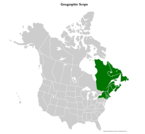
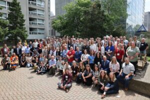
At the first-ever Northeastern North America / Turtle Island Landscape Connectivity Summit in June of 2024, this concept of connected landscapes was at the forefront of presentations, panels and discussion groups focused on transboundary conservation efforts in this region. The Summit focused on the five eastern-most Canadian provinces, seven northeastern-most US states, and Indigenous territories of the region. Attendees included tribal leaders, representatives from provincial, state and federal agencies, and non-governmental organizations, among others, who all came together to collaborate across international boundaries.
The region in focus represents a biodiverse, ecologically-rich carbon sink of utmost importance. Deb Kmon Davidson, Chief Strategy Officer with the Center, said there is a trend in species moving north, such as sugar maples, which she says are dying off in places like Massachusetts, Connecticut and southern Vermont. The solution, according to Davidson, is to work together across borders and with managers of different lands both public and private.
“There’s an increased recognition that this is an interwoven landscape,” Davidson said. “Each state and province is not an individual entity, there’s a collective impact.”
At the summit, road ecology and wildlife migration issues were front and center resulting in much more sharing of information across international borders and efforts to collectively put forward proposals. In September of 2024, Canadian Premieres and American Governors signed a landmark resolution representing a commitment from those provinces and states to work collectively on ecological connectivity.
Moving forward, the hope is that all stakeholders view conservation from an eco-regional perspective that ignores boundaries, according to Davidson.
“There’s power in, for example, people who live within Vermont, understanding that they are part of a larger regional movement, too,” Davidson said.
In April 2025, the coordinating committee that formed around the summit will release a Pathways document that summarizes the findings of the summit and some high-priority action items that were identified. It will be important to ensure that ecological processes and wildlife in the region are able to move and flow as they need to, unimpeded by borders they don’t recognize.
Top photo: Reserve rangers and collaborators from the Turkmenistan and Uzbekistan environmental ministries and the Uzbekistan Academy of Sciences discuss data entry using the SMART system – CLLC/Gabriel Oppler