Roads can have many negative impacts on our natural world. Road ecologists study both the effects of roads on wildlife—such as roadkill and habitat fragmentation—and how to reduce these impacts. However, road ecologists can’t identify problem areas or develop solutions without a strong baseline of information on where and when animals attempt to cross roads or are struck by vehicles. Fortunately, new technology has created an opportunity for the public to help collect this data, and the Center is making this tool widely available.
The Challenge of Studying Wildlife-Vehicle Collisions
 Annually in the U.S., wildlife-vehicle collisions cause 1-2 million large mammal deaths, 26,000 human injuries, and 200 human fatalities. Collisions between wildlife and vehicles have increased by 50 percent over the most recently reported 15 years, costing Americans $8 billion annually. Additionally, roads can act as barriers to wildlife movement, reducing animals’ ability to find adequate food, water, or mates, or complete their seasonal migrations.
While data exist for crashes with wildlife that are reported to law enforcement and insurance companies, these represent only a small fraction of all wildlife-vehicle collisions, and generally only include crashes with common animals the size of a deer or larger. Some states collect information on where maintenance crews remove roadkill, but this is not universal or standardized.
Crash and roadkill data provide some insight into the impact of wildlife-vehicle collisions on human safety, but they do little to aid our understanding of the impact of roads and traffic on wildlife. Citizen-gathered data is crucial to fill this gap in order to plan and implement solutions that benefit both people and wildlife.
Technology Enables Volunteers to Assist Road Ecologists
To improve and standardize road-related wildlife data available to federal land managers—such as in national parks—a new tool was created. The National Park Service and US Fish and Wildlife Service partnered with the Western Transportation Institute (WTI) to develop the ROaDs (Roadkill Observation and Data System) tool to facilitate collection of data on wildlife-vehicle interactions on federal lands with a smartphone app.
To address the need to standardize data collection outside of federal lands and to enlist volunteers in collecting the data, the Center for Large Landscape Conservation worked with WTI to adapt the ROaDS system for other users, including citizen scientists. The Center is now helping to make the ROaDS tool widely available to local coalitions, nonprofit organizations, tribes, and other groups for use in road ecology projects.
The easy-to-use smartphone app allows citizens to get directly involved in road studies in their communities. The data they collect assists road ecologists in developing a comprehensive understanding of the effects of highway corridors on wildlife movement and survival. This information can then be used by community members, local officials, and state agencies to ensure that transportation plans include measures that reduce wildlife-vehicle collisions and habitat fragmentation, making transportation infrastructure safer for people and wildlife.
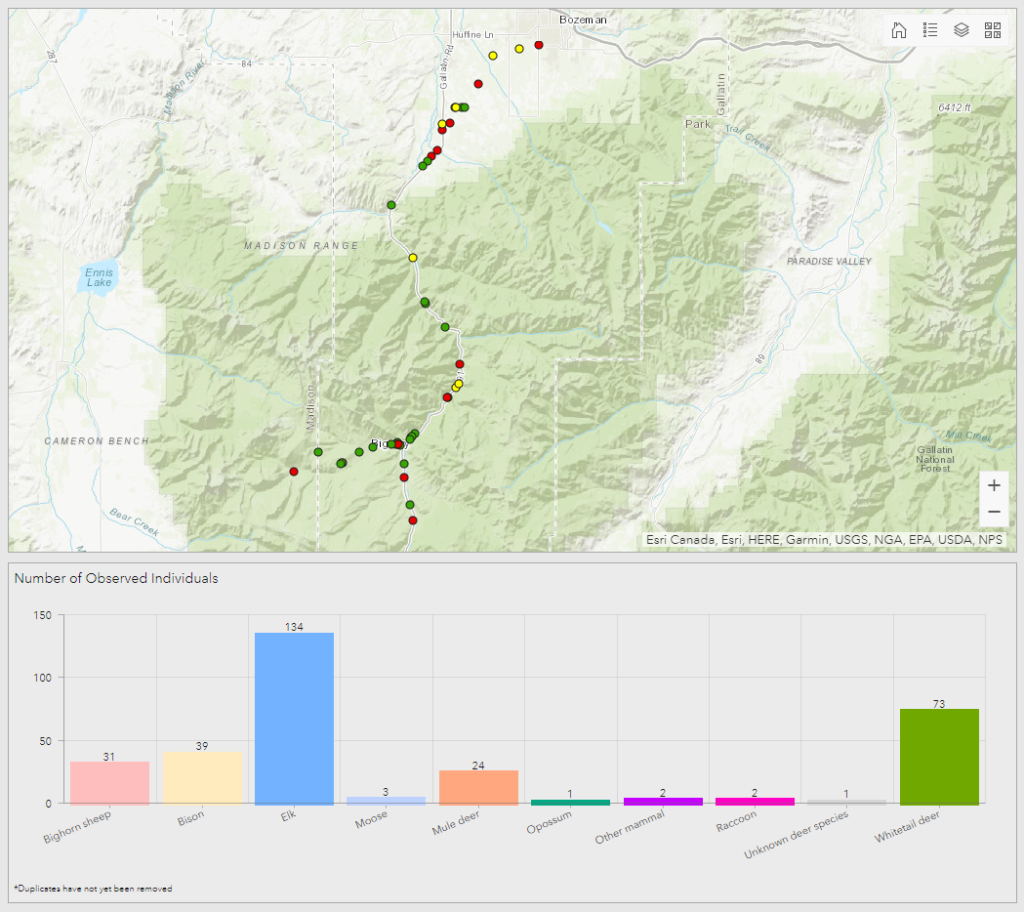
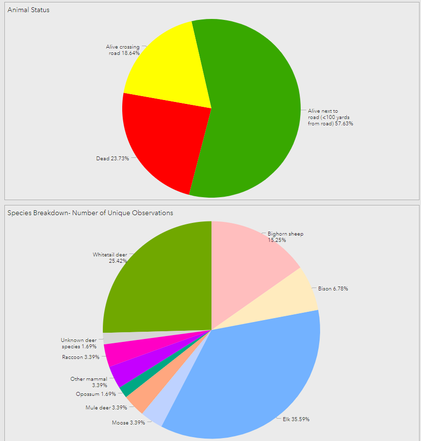
The Center provides set-up, training, and consultation to groups that want to use the ROaDS tool. Some groups then undertake the data-collection effort on their own, while others work with the Center on volunteer recruitment and training. The Center also compiles and analyzes the data for some projects and has developed an online dashboard that allows app users to observe their contributions in real-time.
ROaDS Tool in Action
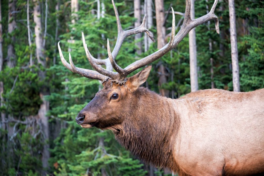
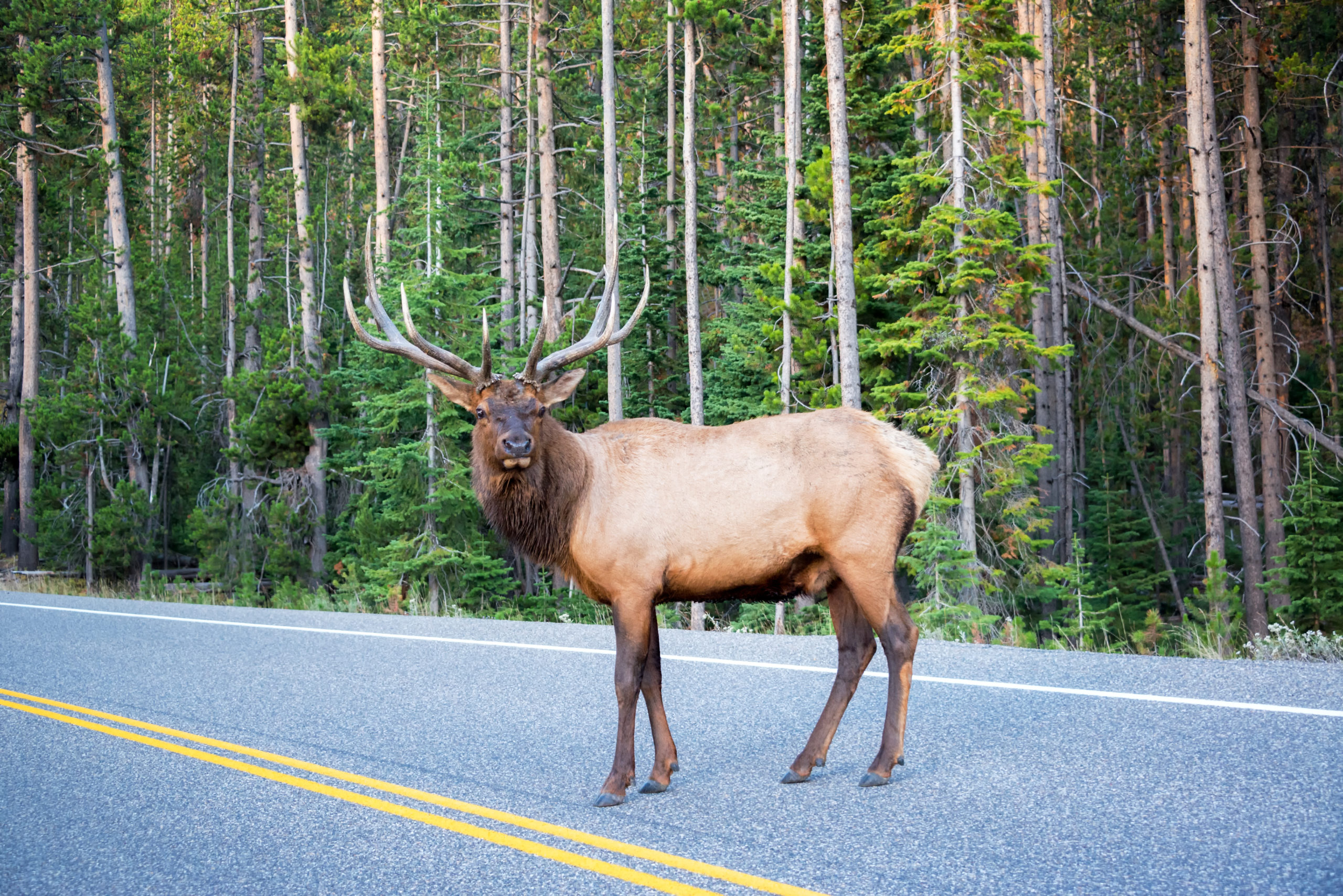
With the ROaDS tool, community members record locations of both roadkill and live animals they observe as they go about their daily lives and utilize the major roadways in their area. For example, citizen scientists are currently monitoring stretches of US Highways 89 and 191 in Montana. These areas connect Yellowstone National Park to large swaths of public land that provide important seasonal habitat for some of North America’s most iconic wildlife species.
The information gathered with the help of citizen scientists will provide area communities and county and state officials with valuable information on wildlife-traffic interactions. Future transportation planning efforts can utilize this information to improve traveler safety and maintain healthy and resilient wildlife populations in the Greater Yellowstone Area.
How it Works
The ROaDS tool takes only about five minutes for a citizen scientist to download and set up on a smartphone. Then whenever travelers spot wildlife along a stretch of road within a study area, they can pull over to complete a brief form on their phone or have a passenger record the information. Typically, the entire process takes a minute or less.
The data a citizen scientist enters in the app then appears on the dashboard, allowing volunteers and the public to visualize sightings readily. Decisionmakers can use the dashboard data as an additional set of information about traffic safety and wildlife population protection, making roads safer for humans and animals alike in the future.
Learn More
For information on using the app to collect data for your group or organization’s project, contact Elizabeth Fairbank, Corridors & Crossings Program Officer, at liz@largelandscapes.org
If you travel daily in one of the Montana study areas (Highway 191 or 89) and wish to use the app as a citizen scientist, contact Braden Hance, Conservation Associate, at bradenhance@largelandscapes.org
Read more about projects and groups that are using the app:
Yellowstone Safe Passages
US-191 Wildlife & Transportation Assessment