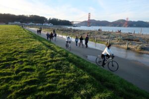
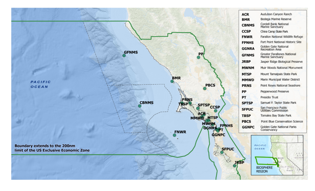
The Golden Gate Biosphere Network (GGBN) is located in the North Central Coast of California, more commonly known as the Bay Area. The network is focused on protecting and enriching the natural and human systems of its biosphere region. The GGBN spans more than 7 million hectares (28,000 square miles) of terrestrial, coastal, and marine land and seascapes.
Climate Change Vulnerability Assessment (CVA)
The impact and speed of climate change on the Bay Area has drastically reduced the effectiveness of historic data used to inform land stewardship decisions. Predictions based on new data were needed. To address this the GGBN partnered with EcoAdapt, a climate adaptation and resilience focused non-profit based in Washington state, on a Climate Change Vulnerability Assessment (CVA) of the biosphere region (BR).
The GGBN’s partners include federal, state, and local governmental agencies, non-profit organizations, and universities. All of whom manage protected landscapes in the BR. Participation in the GGBN provided our partner a platform to combine their efforts and resources to produce these CVAs. The CVA, its findings and recommendations will directly guide on-the-ground project work and long-term land management planning.
Project Scope
All of the GGBN’s coastal and terrestrial lands comprise the analysis area. Landscape-level conservation efforts are at the heart of this project. Working at the Biosphere Region’s scale presents the best opportunity for analysis recommendations to be applied in collaborative multi-organizational on-the-ground project work.
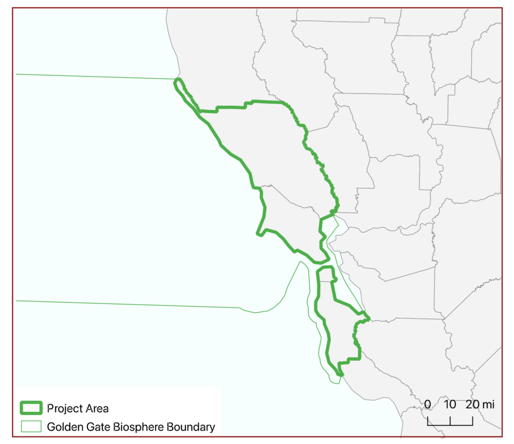
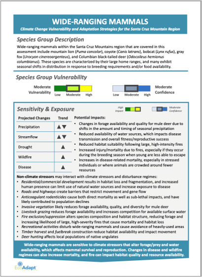
Twenty-one resources were chosen for study; ten ecosystems and eleven species. Resources were chosen to ensure that the majority of the coastal and terrestrial landscapes and their resident species were represented by direct study or proxy.
Spatial Analysis
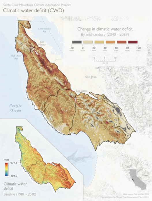
The study examines two timelines: recent (1981-2010), to be used as baseline information and, Late-Century (2070-2099), with thirty-year averages used to show trends over a period of time as opposed to the variability between years.
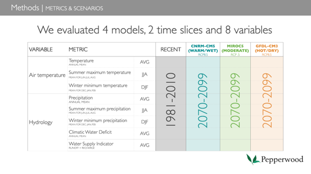
At the time scale of a century, the data provides land-managers with an unprecedented level of information to drive their work plans. The study will model climate-driven shifts in distribution at the scale of landscape units, with results expressed as increase/decrease/stable under four potential climate futures for each vegetation type associated within a landscape unit. The annual temperature average, minimum and maximum across the system will be modeled. Hydrologic modeling includes annual runoff and recharge of the surface and groundwater which provides an indicator of variability in the water system and the annual Climatic Water Deficit which measures the limits of soil moisture available to plants and helps to predict plant ranges and drought stress.
Communicating Data & Next Steps
The raw data generated by these models will be analyzed and formatted for distribution in a variety of modes, including charts, graphs, and full-color localized maps. Developing site-specific maps allows land managers, scientists, and the public an approachable means of connecting with the data.
Following completion of the assessments, EcoAdapt will provide a full project report and focused resource briefs including recommendations for adaptation, resiliency, and mitigation. The resource briefs will provide the foundational information, predictions, and recommendations to land-managers for immediate implementation in their work plans. All produced materials will be featured on the GGBN website.
Following project completion, the GGBN & EcoAdapt will host an two-day in-person workshop in the Fall of 2023. Open to all GGBN partners, members, and targeted Bay Area stakeholders, the workshop will primarily focus on the strategies and actions that can be implemented immediately.
For more information, please reach out to Samuel Cuthell, the Network Coordinator of the Golden Gate Biosphere Network.
Email:
Website: GoldenGateBiosphere.org
LinkedIn: Golden Gate Biosphere Network