As the world trends towards rapid and unchecked development, protected areas pay the price by becoming more and more isolated. Case in point: the large region of South America that is covered by two ecosystems, the Pantanal (the largest tropical wetland) and the Gran Chaco (South America’s largest seasonally dry tropical forests) is at risk of encroachment and fragmentation. The region—the size of Texas, California, and Montana combined—covers parts of four countries: Bolivia, Paraguay, Brazil, and Argentina, and is home to an amazing array of wildlife, including jaguars, giant anteaters, giant otters, tapirs, hyacinth macaws, caimans, and many more.
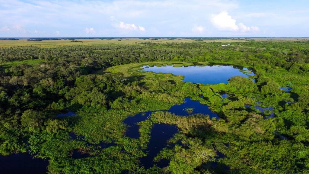
In the Pantanal, threats include industrial-scale agriculture, hydroelectric power plant construction, and extreme climate-driven heat and drought that result in unprecedented, catastrophic fires.
The Gran Chaco ecosystem faces land clearing for agricultural expansion—mostly cattle and soy production—plus soil degradation and biodiversity loss.
Habitat loss and fragmentation cause formerly abundant wildlife to disappear and may result in inbreeding, which can cause genetic deformations in remaining, isolated populations. Protecting and conserving nature in national parks, ecological reserves, Indigenous territories, and private lands is a key strategy to address habitat loss, but it needs to be complemented by actions to counteract the ongoing land fragmentation and ensure that strongholds of biodiversity remain connected. Therefore, as part of the Wildlife Connect initiative, the Center for Large Landscape Conservation and WWF are collaborating with experts from Bolivia, Paraguay, Brazil, and Argentina to identify the ecological network for jaguars in PACHA (short for Pantanal and Chaco); essentially, in order to effectively protect, we must connect.
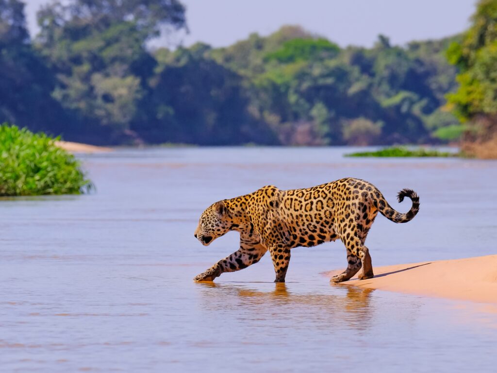
The jaguar was selected as the focal species for this project because it is wide-ranging, sensitive to human-caused landscape changes, and relatively well studied. And importantly, conserving connectivity for jaguars is also likely to conserve connectivity for many other species.
The entire process depends on effective communication and collaboration. Relying on the knowledge of experts in jaguar biology and local ecology, the team has mapped 57 protected and conserved areas and Indigenous territories, among which connectivity should be maintained. They then identified landscape variables that influence jaguar movement and characterized their effect on how jaguars move through the landscape.
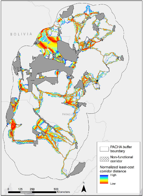
Jaguars, for example, are known by experts to prefer strolling through trees and shrubs over moving through grassland and cropland. They avoid major roads but like water. Using this information, we created a map that shows how likely jaguars are to move through every part of the landscape, and then used this map to find the pathways, or corridors, that are the easiest routes for jaguars to take to get from one protected or conserved area to the next (see map).
While in most cases, corridors are relatively linear, others may follow a curving river. Many of the corridors are composed of multiple strands which are alternate routes. In that case, there are different options for which ones to target for conservation action.
Using a tool specifically designed for the task, we determined which corridors and protected areas are most important for keeping the PACHA network connected.
We also conducted a separate analysis to measure the level of connectivity between pairs of protected or conserved areas, which allows us to track how connectivity is changing over time.
The next step in the project will be for the team to determine the most important corridors for conservation action in the spring of 2024. This process will take into account the connectivity value and other ecological, economic, and social benefits provided by corridors, the costs of land acquisition or protection, the magnitude and immediacy of threats to corridors from development, and the degree of local support for conservation. Thus, mapping the ecological network is only one piece of a more comprehensive conservation effort to maintain long-term connectivity for jaguars and many other species in the richly biodiverse PACHA landscape.
Update 4/30/24: In a second phase of the project, we are determining the most important corridors for conservation action, taking into account several factors: the connectivity value and other ecological, economic, and social benefits provided by corridors; the costs of land acquisition or protection; the magnitude and immediacy of threats to corridors from development; and the degree of local support for conservation.
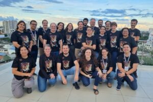
During an April 2024 workshop in Santa Cruz, Bolivia, which was organized and hosted by Rafael Antelo with WWF-Bolivia, we guided 23 participants from Argentina, Bolivia, Brazil, and Paraguay, representing various organizations and government bodies, in the identification of prioritization criteria related to corridor values, threat, and opportunities. Examples of these criteria include the biological importance of the corridor as well as the protected areas on both ends, documented jaguar movements, the density of existing and planned roads, the risk of conversion of intact habitat in the corridor to agriculture, the capacity of the civil society for conservation, and existing conservation plans.
The Center for Large Landscape Conservation will now score corridors based on these criteria and identify the top 10 corridors for conservation action in the entire Pantanal-Chaco region as well as in each of the 4 countries. Thus, the project outcomes can guide conservation efforts in the Pantanal-Chaco landscape, ensuring effective allocation of resources to preserve ecological connectivity and biodiversity in the future.
* Wildlife Connect is a joint initiative of WWF, the Center for Large Landscape Conservation, the IUCN WCPA Connectivity Conservation Specialist Group, and the Convention on Migratory Species.